Frank gives us a masterclass in community organising. He just so happens to have geospatial capability also. He provides several fantastic examples of geospatial outputs and acquisition of political power by communities that he has served.
Frank is a hero. Frank provides pathways to prosperity for young men. Frank leverages the power of drones to make youngsters keen about what we do. He has had success all over the US and internationally such as in India.
This is a whole new world for our profession. There is an emerging trend in consulting firms of social value. Thankfully. None however are as successful and heroic in their impact as RomoGIS.
GUN VIOLENCE
Another community organisor is David Hogg. He survived the 2018 Parkland Highschool shooting. Who can remember amongst all the others that have happened since? His incredible political progress addressing this issue is profiled in Michael Moore’s Fahrenheit 11/9 documentary:
On Xitter, David summed up why gun violence exists:
This was met with 39,000 likes.
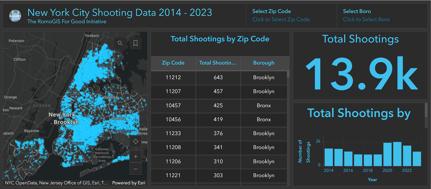
Other school children echo these views and identify gun violence as an issue in community organising by Frank. A theme of his success here has been gun violence map apps. He emphasised in our discussion that these are the result of asking school students about what is important to them. He then helps organise to access power so that these issues can be addressed. An example of accessing power through geospatial data is this dashboard about shootings in New York:
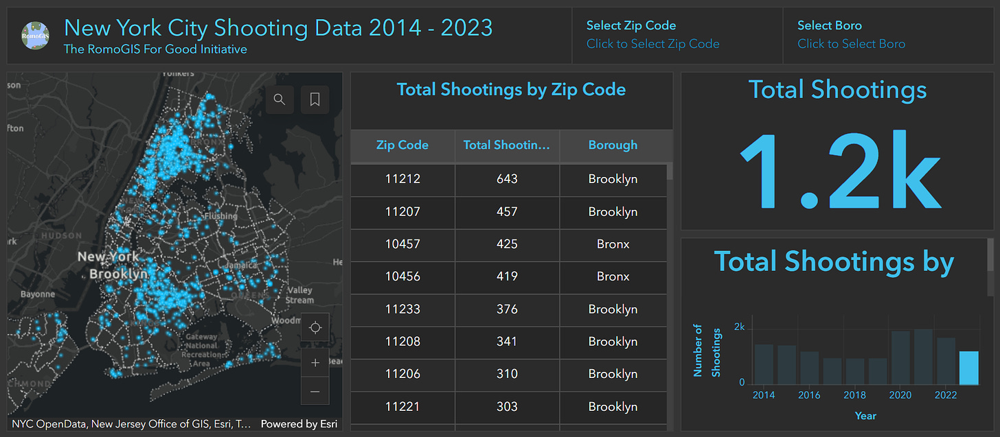
If you click on a year in the lower right bar chart you can see there were 1,200 shootings last year:
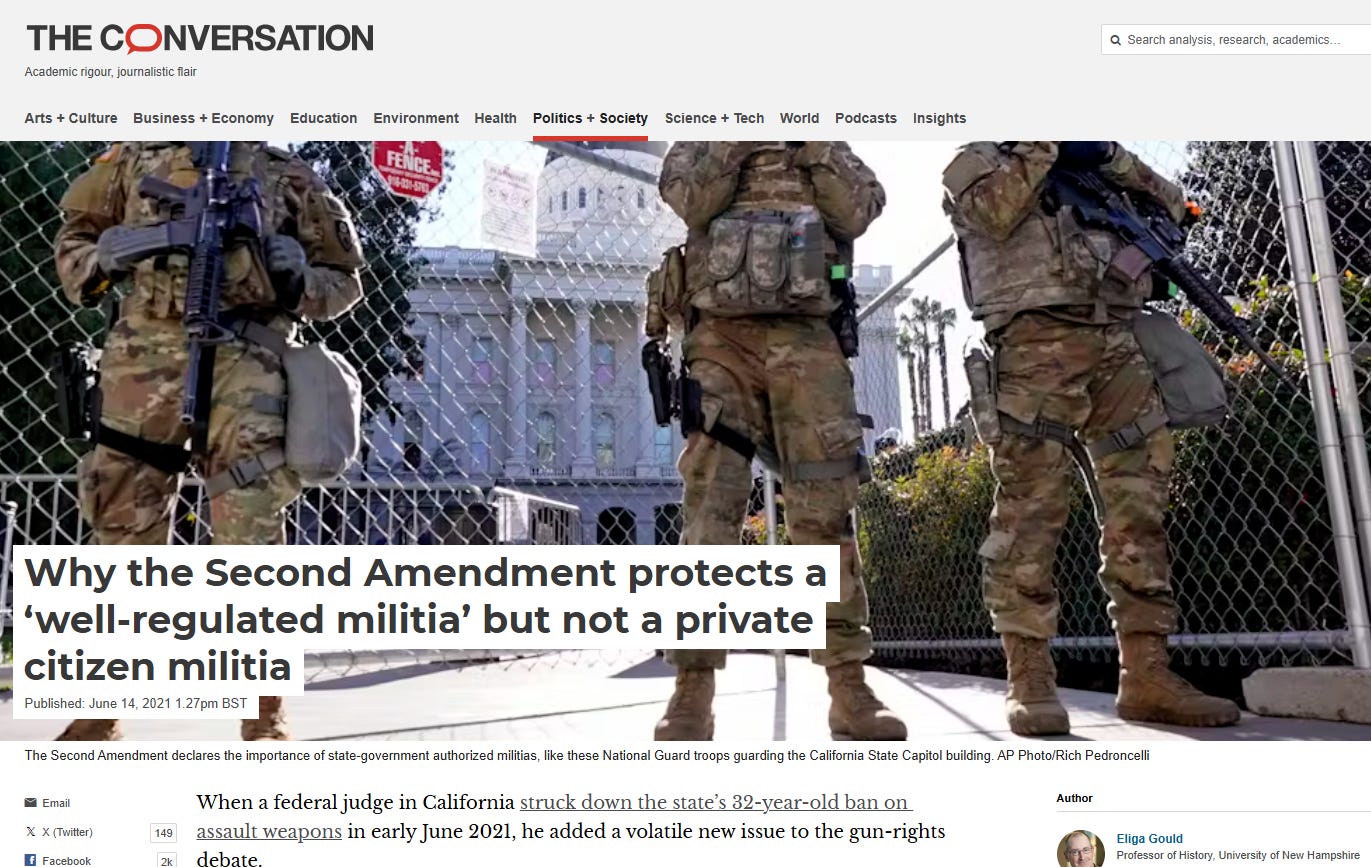
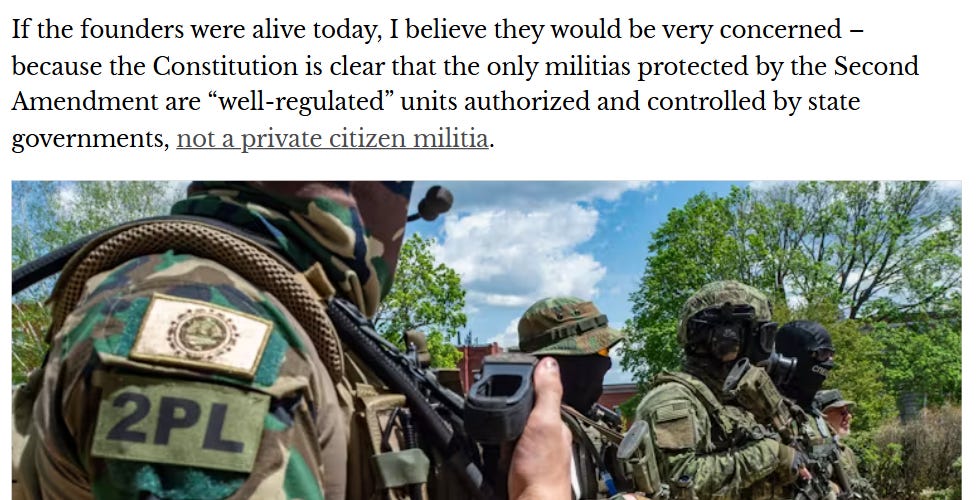
All because of the innocent intent of facilitating the equivalent of a National Guard way back in 1791. For some effective commentary on this issue, we can read ‘Why the second amendment protects a ‘well regulated militia’ but not a private militia’ in The Conversation:
Professor Gould clarifies:
As such, the Second Amendment serves as no justification for the kind of military weapon possession by civilians like we see all over America today.
RomoGIS has also made a couple of ArcGIS hubs which I recommend checkig out. One about gun violence, and another about GIS for good. He was also on this show if you want more:
We are privileged.
Thanks Frank.
THE GEOSPATIAL INDEX
The Geospatial Index is a comprehensive listing of all publicly traded geospatial businesses worldwide. Why? The industry is growing at ~5% annually (after inflation and after adjusting for base rates). This rate varies significantly, however, by sub index. For $480,000 to start, this growth rate is $5,000,000 over a working life. This channel, Bluesky account, newsletter, watchlist and podcast express the view that you are serious about geospatial if you take the view of an investor, venture capitalist or entrepreneur. You are expected to do your own research. This is not a replacement for that. This is not investment advice. Consider it entertainment.
NOT THE OPINION OF MY EMPLOYER
NOT YOUR FIDUCIARY
NOT INVESTMENT ADVICE
Bluesky: https://bsky.app/profile/geospatialindex.bsky.social
LinkedIn: https://uk.linkedin.com/in/geospatialindex
Watchlist: https://www.tradingview.com/watchlists/123254792/
Newsletter:
Podcast:





Share this post