Steve Attewell, UX Design Lead at the UK's Ordnance Survey, one of the world's oldest national mapping agencies, talks us through this repo.
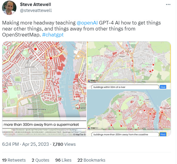
This includes a brief on screen demo of two tools he has created which demonstrate natural language interfaces for mapping the results of queries against OpenStreetMap and Ordnance Survey spatial databases. It was a rich and broad discussion centred around the realisation that we have something that has passed the Turing test on our hands, and what Geospatial could do about it.
Recent developments of his tool, showing spatial analysis is possible, available here.
THE GEOSPATIAL INDEX
The Geospatial Index is a comprehensive listing of all publicly traded geospatial businesses worldwide. Why? The industry is growing at ~13.8% annually. For only $11,600 to start, this growth rate is $5,000,000 over a working life.
This channel, Twitter account, blog, watchlist and podcast express the view that you are serious about geospatial if you take the view of an investor, venture capitalist or entrepreneur.
You are expected to do your own research. This is not a replacement for that. This is not investment advice. Consider it entertainment.
Twitter: https://twitter.com/geospatialindex Watchlist: https://www.tradingview.com/watchlists/19805134/ Podcast: https://podcasters.spotify.com/pod/show/geospatialindex Blog: https://www.geospatial.money/
Meetup: https://www.meetup.com/london-mapup/
NOT THE OPINION OF MY EMPLOYER
NOT YOUR FIDUCIARY
NOT INVESTMENT ADVICE


Share this post